Oceanographic Moorings
Since 2000, the sanctuary has deployed an array of oceanographic moorings to measure properties of seawater along approximately 135 miles of the Olympic Coast. In recent years, 10 sites have been monitored continuously between May and October to document water column conditions during the upwelling season, when ocean conditions fluctuate and tend to worsen in terms of hypoxia, ocean acidification, and other concerning stressors. An additional over-winter mooring is deployed near Teahwhit Head to record ocean temperatures throughout the water column between October and May.
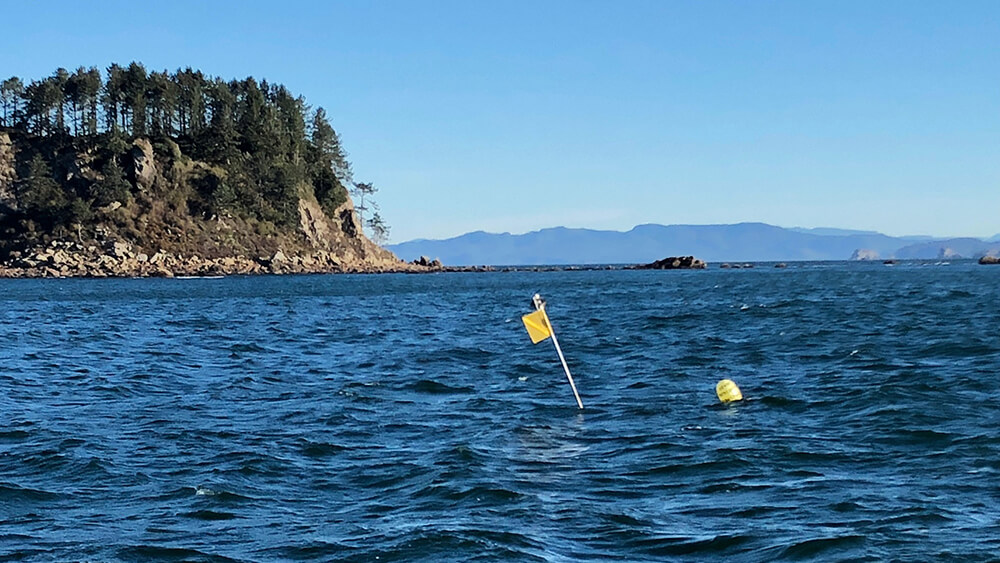
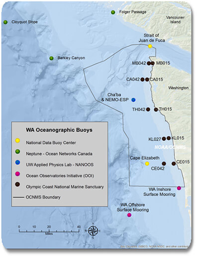
The sanctuary first deployed moorings in 2000, and is currently maintaining ten mooring sites at the locations shown below. The moorings have a lightweight design and are deployed from the sanctuary's research vessel in the spring and recovered in the fall. Several times during the summer, each mooring is recovered for cleaning, servicing, and data download before being re-deployed in the same location.
Mooring Locations
Makah Bay
| Name | Latitude (North) | Longitude (West) | Depth (m, MLLW) |
|---|---|---|---|
| MB015 | 48º 19.523' | 124º 40.610' | 15 |
| MB042 | 48º 19.438' | 124º 44.123' | 42 |
Cape Alava
| Name | Latitude (North) | Longitude (West) | Depth (m, MLLW) |
|---|---|---|---|
| CA015 | 48º 09.978' | 124º 45.410' | 15 |
| CA042 | 48º 09.961' | 124º 49.402' | 42 |
Teahwhit Head
| Name | Latitude (North) | Longitude (West) | Depth (m, MLLW) |
|---|---|---|---|
| TH015 | 47º 52.567' | 124º 37.168' | 15 |
| TH042 | 47º 52.569' | 124º 44.005' | 42 |
Kalaloch
| Name | Latitude (North) | Longitude (West) | Depth (m, MLLW) |
|---|---|---|---|
| KL015 | 47º 36.050' | 124º 25.704' | 15 |
| KL027 | 47º 35.674' | 124º 29.824' | 27 |
Cape Elizabeth
| Name | Latitude (North) | Longitude (West) | Depth (m, MLLW) |
|---|---|---|---|
| CE015 | 47º 21.407' | 124º 20.888' | 15 |
| CE042 | 47º 21.188' | 124º 29.324' | 42 |
Instruments are mounted at various altitudes on the moorings, depending on location. All moorings measure temperature, and several also measure salinity, water velocity and direction, chlorophyll concentration, and dissolved oxygen levels.
Sanctuary monitoring data have been analyzed by NOAA scientists to identify long term trends and have been used to support regional forecasting and prediction efforts including the LiveOcean model for short-term (three day) forecasts of ocean conditions, and the J-SCOPE model for seasonal (six to nine month) forecasts of ocean conditions in the Pacific Northwest.
Our Oceanographic Mooring Data Archive provides processed and standardized data on ocean temperature, salinity, water velocity, dissolved oxygen, and chlorophyll fluorescence collected from the OCNMS mooring program. Data are processed at the end of each survey season and shared with the public as zipped files.
For more information regarding the oceanographic moorings and data, email us at olympiccoast@noaa.gov.