Original Peoples
Human migration across the Bering land bridge into the New World is believed to have occurred anywhere between 12,000 and 30,000 years ago. Some researchers suggest that an additional maritime-based culture hugged the land bridge shore and entered the Americas using watercraft during this period as well. Such populations would certainly have navigated along the Olympic Peninsula’s shoreline and established camps onshore. Archaeological research along the terrestrial boundaries of the sanctuary is inconclusive about the earliest human habitation. The oldest known sites appear around 4,000 to 8,000 years ago.
Archaeologists speculate that ancient Native American archaeological sites off Washington’s coast are likely associated with paleo-shorelines. The sea level history of the Olympic Coast is complicated with older paleo-shoreline likely occurring subtidally and more recent paleo-shoreline occurring above current levels. The sea level 20,000 years ago was about 120 meters lower than present. Glacial melt caused a rise in sea level to a point approximately 20 meters below present by 8,000 years ago and reached modern levels about 2,000 years ago. Researchers believe that between the period 8,000 and 2,000 years ago, the regional sea levels may actually have been at least four meters above modern sea level. This is also supported by Native American oral tradition.
The distribution of historically known Native American tribes along the coastal Olympic Peninsula includes the Makah Tribe to the northwest and the Quileute, Hoh, and Quinault tribes in succession to the south.
For many Indigenous communities, natural resources are cultural resources—inextricably connected to tribal heritage. These living resources, whether marine, riverine, or terrestrial, are the source of tribal origin stories, clan names, art and technology, religion, subsistence foodways, clothing, and trade. Although the National Historic Preservation Act and other governmental guiding documents consider cultural resources as primarily related to archaeology and historic properties, it is important to note that many tribal communities disagree with these strict definitions.
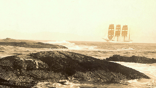
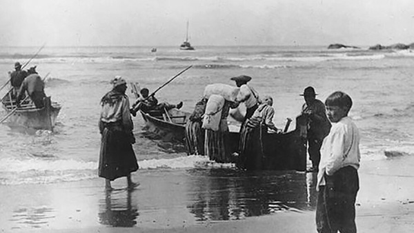
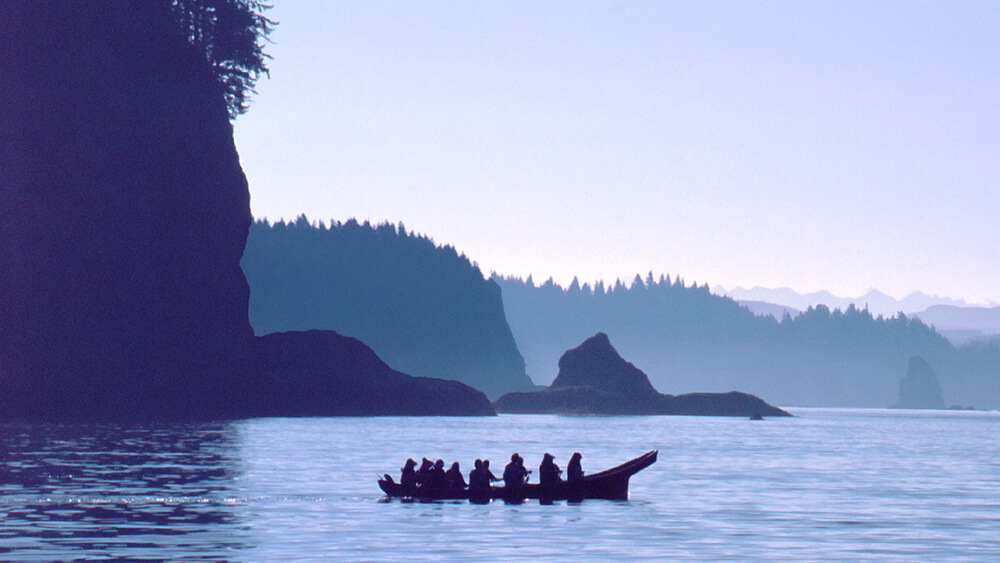
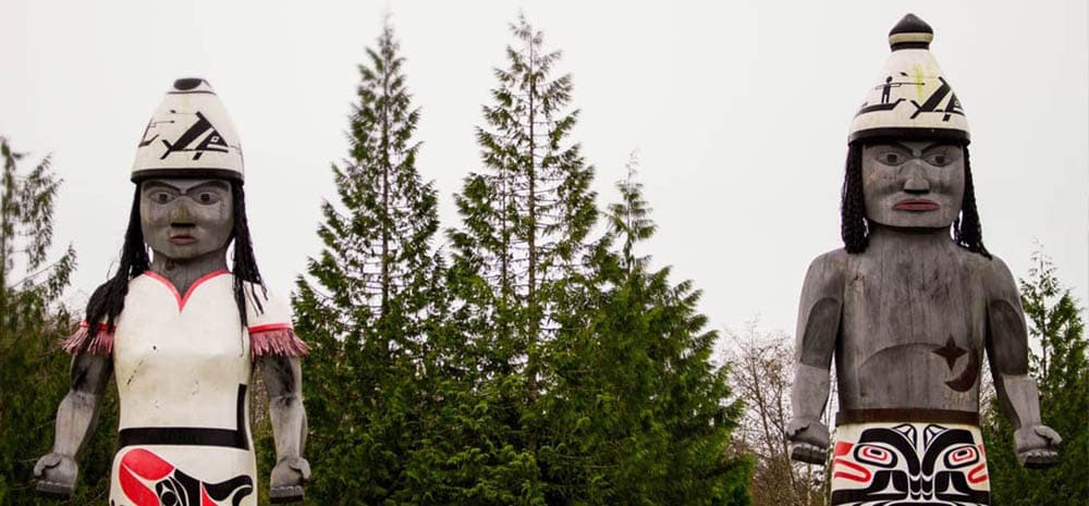
All of the Northwest tribes are renowned for their expert utilization of locally abundant wood for tools, shelter, and watercraft. They created elaborate decorative and culturally specific motifs. Much has been learned about Makah craftsmanship from archaeological remains of the Ozette village site at Cape Alava that dates to about 500 years before present. The region’s tribes were known for their ocean-going dugout canoes. The Makah, in particular, were able to voyage for days out of sight of land to hunt whales.
Makah
The Makah are a traditional maritime culture that derived most of their sustenance from whaling and sealing. They subsisted on seals, both marine and anadromous fish, and marine shellfish. They also hunted waterfowl and large land mammals. Berries, roots, and sprouts composed a small portion of their diets.
The Makah moved between permanent winter and summer villages. The principal Makah villages around Cape Flattery were Neah Bay (or De-ah), Waatch (or Wyaach) at the western end of Makah Bay, and Sooes (or Tsooes) at Makah Bay. Neah Bay has only been the center of tribal government since the nineteenth century. Summer fishing villages were also located at Tatoosh Island, Warmhouse on the strait, and Archawat on the Pacific side of the Cape.
Like most of the Northwest Coast Indians, the Makah were expert woodworkers. Their homes were large, multi-family, pitched-roof sheds, made from split shingle red cedar planks lashed to earth-fast posts. They were also adept at carving log canoes in which they traveled far out to sea to fish and hunt whales and seals. Tribal oral traditions indicate that, prior to European contact, they regularly crossed the strait to trade with their Nuu-chah-nulth relatives at Vancouver Island.
Quileute
The Quileute peoples live immediately south of the Makah. They were the only Chimakum language speakers on the Olympic Coast. Their lands stretched southward from Cape Alava to the Hoh River and eastward to the sources of the Quillayute and Hoh rivers. The Hoh band of the Quileutes lived along the Hoh River to the south. Another band, the Chimakums, who migrated to the Port Townsend area, were wiped out in the 1860s by Chief Seattle's Suquamish tribe.
The primary Quileute town at the mouth of the Quillayute River became known to the Americans as La Push, a corruption of the French "la bouche" or the mouth. Traditionally, most of the Quileute lived inland and visited La Push seasonally to fish. The town is presently inhabited full time and is the center of tribal life. The Quileute and the Makah considered the other to be enemies and raided each other for slaves. Regardless, the tribes also engaged in trade, intermarriage (of nobility), and potlatch ceremonies.
Towering over the entrance to the river is the 200 foot A-Ka-Lat Island (Top of the Rock), also called Alekistet. The island had both great cultural and strategic significance. It was the burial place of Quileute royalty. People were placed in canoe "coffins" and placed on top of the hill. The island was also a source of refuge during fights with the Makah. A store of large logs was kept that could be rolled down upon attackers.
Quileute society was organized around "house group" kinships, each house having a chief. Like the Makah, the Quileute were prodigious wood workers and built large cedar houses with substantial wooden posts and beams. They were also expert canoe builders.
Unlike the Makah, their subsistence did not rely as heavily upon whales. Although they were known to be fine whalers, the Quileute were also experts in hunting seals. They additionally subsisted on shellfish and the bounty of the forest including salmon, elk, bear, deer, wildcat, raccoon, ducks, and geese, in addition to berries and roots.
Like most Northwest Coast tribes, the Makah and Quileute practiced potlatch ceremonies. The potlatch was a feast to celebrate principal events in a tribal member’s life during which lavish gifts were distributed to the guests. This served to notify other tribal members, and even other tribes, about the host’s wealth, and therefore, status. The potlatch provided opportunities for exchanging information, retelling family stories and histories, and for forming alliances between family groups and villages.
Hoh
The Hoh people call themselves Chalá·at (The People Who Live on the Hoh River). While the river gets its name from the Quinault word Hoxw, the Hoh River people themselves, who speak Quileute, call their river Cha'lak'at'sit, which means the "southern river." Their artful navigation of the fifty-mile river allowed them to reach village and fishing sites, hunting encampments, and places where they could harvest plants and other resources. The beaches to the north and south of the river mouth, and the ocean promontories and islands, also supplied the Hoh with subsistence resources.
The Hoh River is clearly the focal feature of Hoh tribal life and territory. In aboriginal times, there was nothing secluded about the Hoh Watershed, even its upper reaches. No less than seven permanent settlements were situated along the banks of the Hoh, most with a fishtrap. The river served not only as a riverine thoroughfare leading to their fishing sites and their hunting, trapping, and foraging grounds, it was also the nursery of the salmon and home of freshwater fishes that they harvested as part of their annual cycle.
The Hoh River watershed included the sites of the burials of their ancestors, the hidden locations of their empowering guardian spirits, and the family campgrounds and upstream summer villages near resource gathering areas that were heritable family property. Besides that, there were named landmarks, sites associated with ritual and mythic occurrences, and riverside trails. The "tAlaykila pots'Okw" (Old-time People) appear to have known the watershed well and exploited it extensively, traversing up and down the river in their shovel-nosed river canoes.
Quinault
In 1855 the Quinault signed a treaty that ceded part of their territory to the United States government, while retaining the portion that constitutes their present day reservation. Shortly thereafter, a considerable number of people from neighboring tribes moved, or were transferred, to the Quinault reservation. Hence, today the Quinault Tribal membership includes seven distinct groups—Quinault, Quileute, Queets, Hoh, Chehalis, Chinook, and Cowlitz, as well as many sub-bands that have been absorbed or lost individual identity.
The name Quinault stems from kwínayt, the Quinault word for the largest village at the mouth of the Quinault River, now known as Taholah—the seat of the present day tribal government. Famously, the Quinault constructed superior canoes, with high bows and sterns (many of which could carry 50 to 60 people), which they traded and sold in the Puget Sound and Columbia River regions. Quinault trade networks were extensive. The Makah, rich in whale oil and dentalium shells, would trade for the famed Quinault “Blueback” sockeye salmon, sea otter skins, and dried elk meat, while the tribes to the south would trade dried razor clams and wild, edible bulbs such as camas, lacamass, or quamash (Camassia quamash) and wapato, or duck potatoes (Sagittaria latifolia).
Today, the Coastal Treaty Tribes (Hoh, Makah, Quileute, Quinault) carry their heritage forward, balancing the very modern needs of their communities with long tradition. Tribes exercise their treaty rights, hold potlatches and ceremonies (e.g., first salmon ceremony), and celebrate their cultures through songs, dances, names, language, and more.
In 2007, in recognition that the Hoh, Makah, and Quileute tribes; the Quinault Indian Nation; and the state of Washington are managers of the fisheries resources and their habitats within the sanctuary, the Intergovernmental Policy Council (IPC) was formed. The first of its kind within the National Marine Sanctuary System, the IPC provides a regional forum for resource managers to exchange information, coordinate policies, and develop recommendations for resource management within the sanctuary. However, this forum does not supplant the federal trust responsibility or direct government-to-government relationships between the sanctuary and individual tribal governments.